Antrim Glens - Discover Northern Ireland
Antrim Glens - Discover Northern Ireland
Antrim Glens - Discover Northern Ireland

Create successful ePaper yourself
Turn your PDF publications into a flip-book with our unique Google optimized e-Paper software.
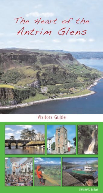
The Heart of the<br />
<strong>Antrim</strong> <strong>Glens</strong><br />
Visitors Guide<br />
SHANWAY, Belfast
<strong>Ireland</strong><br />
CORK<br />
DERRY<br />
Co. <strong>Antrim</strong><br />
BELFAST<br />
DUBLIN<br />
Driving Distance from Cushendall<br />
Belfast 52 miles 85 Km<br />
Ballycastle 15 miles 24 Km<br />
Ballymena 18 miles 30 Km<br />
Larne 26 miles 43 Km<br />
Giants Causeway 30 miles 48 Km<br />
Belfast Int. Airport 30 miles 48 Km<br />
Dublin 152 miles 249 Km<br />
The <strong>Glens</strong> of <strong>Antrim</strong><br />
Giants Causeway<br />
DERRY<br />
BALLYMENA<br />
Cushendun<br />
Cushendall<br />
Glenariff<br />
PORT OF LARNE<br />
County <strong>Antrim</strong><br />
BELFAST INTERNATIONAL<br />
BELFAST<br />
BELFAST CITY<br />
Ferries<br />
between<br />
Scotland,<br />
England.<br />
DUBLIN AIRPORT<br />
DUBLIN<br />
Ferries<br />
between<br />
England,<br />
France, Spain
contents<br />
Heart of the <strong>Glens</strong> 2<br />
The Nine <strong>Glens</strong> of <strong>Antrim</strong> 3<br />
History of the area 4<br />
Landscape and Folklore 6-7<br />
Wildlife 8-9<br />
Glenariff 10<br />
Cushendall 15<br />
Cushendun 21<br />
Walks 28<br />
Area Map 30-31<br />
Scenic Drives 32<br />
Activities and Events 36-37<br />
Useful Contacts 38<br />
Church Services 39<br />
Further Information<br />
Acknowledgements 40
<strong>Ireland</strong><br />
CORK<br />
DERRY<br />
Co. <strong>Antrim</strong><br />
BELFAST<br />
DUBLIN<br />
Driving Distance from Cushendall<br />
Belfast 52 miles 85 Km<br />
Ballycastle 15 miles 24 Km<br />
Ballymena 18 miles 30 Km<br />
Larne 26 miles 43 Km<br />
Giants Causeway 30 miles 48 Km<br />
Belfast Int. Airport 30 miles 48 Km<br />
Dublin 152 miles 249 Km<br />
The <strong>Glens</strong> of <strong>Antrim</strong><br />
Giants Causeway<br />
DERRY<br />
BALLYMENA<br />
Cushendun<br />
Cushendall<br />
Glenariff<br />
PORT OF LARNE<br />
County <strong>Antrim</strong><br />
BELFAST INTERNATIONAL<br />
BELFAST<br />
BELFAST CITY<br />
Ferries<br />
between<br />
Scotland,<br />
England.<br />
DUBLIN AIRPORT<br />
DUBLIN<br />
Ferries<br />
between<br />
England,<br />
France, Spain
Heart of the <strong>Glens</strong><br />
In an age of uncertainty and change it is refreshing to<br />
visit a place like the <strong>Antrim</strong> <strong>Glens</strong>, where the pace of<br />
life is leisurely; the people are welcoming, the air is<br />
fresh and the countryside is beautiful.<br />
This is a peaceful landscape - one to delight the<br />
walker, the cyclist, the fisherman, and the lover of<br />
nature. Time stands still among these green hills and<br />
valleys.<br />
The sea of Moyle laps on the rocky shore; the coast<br />
of Scotland a mere fourteen miles distant, can be<br />
plainly seen on a clear day. Hugging the shore, travelling<br />
over towering headlands, weaving under bridges and<br />
arches, winding past bays, sandy beaches and strange<br />
rock formations, the <strong>Antrim</strong> Coast Road skirts them<br />
all and drops in on the distinctive pastel-painted villages<br />
at their feet. The <strong>Antrim</strong> Coast Road has been ranked<br />
number five in the world and number one in Europe for<br />
its spectacular views.<br />
The surrounding hills and glens are a patchwork of hill<br />
farms, small fields hedgerows and traditional stone<br />
walls. Fast flowing streams and winding rivers run to<br />
meet the sea.<br />
The pace of life is what you make it in this unique and<br />
beautiful corner of <strong>Ireland</strong>.<br />
2 | The Heart of the <strong>Glens</strong>
The Nine <strong>Glens</strong> of <strong>Antrim</strong><br />
Glentaisie - Glen of Taisie of the bright sides<br />
<strong>Glens</strong>hesk - Sedgy glen<br />
Glendun - Glen of the brown river<br />
Glencorp - Glen of the slaughtered<br />
Glenaan - Glen of the colt’s foot<br />
Glenballyeamon - Glen of Eamon’s homestead<br />
Glenariff - Arable or fertile glen<br />
Glencloy - Glen of the hedges<br />
Glenarm - Glen of the army<br />
The Heart of the <strong>Glens</strong> | 3
Human settlement has existed here<br />
since neolithic times, and the<br />
mountain Tievebulliagh (just northwest<br />
of Cushendall) was important<br />
then as one of the few sources of the<br />
rock porcellanite. Arrow, spear and axe<br />
heads made of this were exported<br />
from the area through Europe to the<br />
fringes of Asia. After stone came<br />
bronze, and the focus shifted to<br />
Lurigethan, where a promontory fort<br />
enclosed 30 acres of the mountain<br />
overlooking Glenariff and Cushendall.<br />
In turn, it too was abandoned in favour<br />
of homesteads, which were walled for<br />
protection against raiders. A<br />
particularly fine example of one of<br />
these can be seen in the Altagore<br />
cashel just north of Cushendun. This<br />
early Christian enclosure must have<br />
seen its share of visitors, as Vikings<br />
roamed around the lands. And did the<br />
Saxons come as well? Coins of the<br />
King of Mercia were found in the<br />
construction of Waterfoot pier at the<br />
foot of Glenariff.<br />
At this time the area was part of the<br />
Celtic Kingdom of Dalriada,<br />
commemorated by street names in<br />
Cushendall. Its Chieftains crossed the<br />
narrow sea to set up Scottish Dalriada,<br />
and ever since then there have been<br />
close links between<br />
the two lands.<br />
history<br />
Millenium Cairn<br />
Glenariff from Lurigethan<br />
4 | The Heart of the <strong>Glens</strong>
Fairy tree<br />
Layde Graveyard<br />
Red Bay Castle<br />
By the late thirteenth century,<br />
ownership of the <strong>Glens</strong> had passed to<br />
the Earl of Ulster, who sold it on to an<br />
exiled Norman family, the Bissetts.<br />
They built the first stone castle at Red<br />
Bay and ruled until 1399, when John<br />
Mor McDonnell, second son of Lord of<br />
the Isles, married the heiress Margery<br />
Bissett. For 200 years the McDonnells<br />
held the <strong>Glens</strong> by force of arms, most<br />
famously under the leadership of<br />
Sorley Boy (1505-89). Then came the<br />
turbulent years of the 17th century,<br />
when the estate was lost and<br />
regained. Finally, following the<br />
Williamite victory (1690), an area of<br />
8000 acres around Cushendall and<br />
Cushendun was forfeited and sold.<br />
Many McDonnells still rest here, at<br />
Layde Church on the heights above<br />
Red Bay.<br />
Cushendall was purchased by Francis<br />
Turnly in the early 19th century. He<br />
developed the village and improved<br />
the Coast Road between it and his<br />
home near Carnlough, so creating a<br />
local landmark, the Red Arch.<br />
A magnificent engineering feat in its<br />
day, this road has made many isolated<br />
communities accessible<br />
and opened the beauty of the<br />
land for all to see.<br />
The Red Arch<br />
The Heart of the <strong>Glens</strong> | 5
landscape<br />
The landscape of the glens is a<br />
combination of natural forces and<br />
generations of human activity. It has<br />
resulted in an unrivalled variety of<br />
landscapes for such a small region.<br />
This is officially recognised in the<br />
designation of the area as an Area Of<br />
Outstanding Natural Beauty (AONB).<br />
The actual shape and form of the<br />
land in the AONB is the culmination of<br />
many earth forming forces at work<br />
over a long period of time. Most<br />
important amongst these was the<br />
volcanic lava outpourings about 50-60<br />
million years ago which produced a<br />
massive hard basalt plateau overlying<br />
softer sedimentary rocks of chalk, clay<br />
and sandstone.<br />
The present shape and form of the<br />
glens and coast is the result of intense<br />
glacial erosion during the last<br />
glaciation which was drawing to a<br />
close only 17,000 years ago. Ice<br />
sculpted the landscape deepening preglacial<br />
valleys as at Glenariff and<br />
Glenballyeamon. Little of the<br />
landscape remains truly natural.<br />
People living and working the land<br />
have created their own landscapes of<br />
farm, field, hedgerow, wall and<br />
dwelling. All of these add to the<br />
heritage of the area.<br />
After the last Ice Age most of <strong>Ireland</strong><br />
was covered by oak, pine and birch<br />
woodland. The arrival of the first Stone<br />
Age farmers, around 3000 BC, led to<br />
the clearance of the forests.<br />
By the 1400s, only 12% of the island<br />
was forest and this was mainly in the<br />
lowland river valleys. Oak, ash and a<br />
few elm trees predominated, with oak<br />
and birch on higher ground.<br />
The open landscape without permanent<br />
field boundaries remained until the<br />
early 1800s. The increase in population<br />
led to the development of small<br />
villages or ‘clachans’, with farms, which<br />
were run on a partly collective system.<br />
These were inefficient and in the late<br />
18th and early 19th Centuries, they<br />
were reorganised and the land was<br />
redistributed. The resulting patchwork of<br />
small fields around the <strong>Antrim</strong> <strong>Glens</strong><br />
and Coast, contrasts with the open<br />
moorland above. In Glenariff, the<br />
distinctive pattern of ladder farms can<br />
be seen running upslope from the<br />
valley floor, each farm thus ensured a<br />
share of lowland, glen side and hill<br />
ground. The grazing of thousands of<br />
sheep has resulted in the grassy fields<br />
with occasional whins.<br />
Landlords, such as Turnly at Cushendall ,<br />
White at Cushendun and Dobbs at<br />
Glenariff planted woodlands and in the<br />
20th century large areas of conifers<br />
were planted by the government<br />
forestry department.<br />
Each glen and valley has its own<br />
particular personality and charm, a<br />
consequence of the unique combination<br />
of rocks, soils and exposure together<br />
with the history of its people.<br />
6 | The Heart of the <strong>Glens</strong>
folklore<br />
The alternative history of the <strong>Glens</strong> is<br />
much more colourful and romantic. It is<br />
filled with stories of fairy folk, ancient<br />
heroes such as Ossian and Fionn<br />
McCumhaill and well known Celtic<br />
legends including the story of the<br />
Children of Lir.<br />
The Children of Lir<br />
Lir was a famous Irish Chieftain whose<br />
wife died after giving him a daughter<br />
and three sons. He then married his<br />
dead wife’s half-sister, who was jealous<br />
of Lir’s love for his four children. She<br />
cast a spell on them turning them into<br />
beautiful white swans, and they were<br />
destined to spend nine hundred years<br />
in exile. Three hundred of these years<br />
were passed here, on the Waters of<br />
Moyle, and the birds’ lonely cries were<br />
heard about the bay. Finally, on the<br />
coming of Christianity to <strong>Ireland</strong>, the<br />
Children of Lir regained human form.<br />
Old and weak, they were baptised and<br />
died together.<br />
Every autumn, flocks of wild swans<br />
fly in over this north coast on<br />
migration from Iceland to spend the<br />
winter in <strong>Ireland</strong>’s milder climate.<br />
Their haunting and musical calls are a<br />
reminder of one of <strong>Ireland</strong>’s favourite<br />
legends.<br />
Fairy Folk<br />
The fairies were believed to live in<br />
many small green hills, raths, found<br />
throughout the countryside but<br />
Tiveragh was a special abode.<br />
Sometimes they might appear as a<br />
cloud of moving lights or very sweet<br />
“fairy music” might be heard which<br />
had the power to lure people away.<br />
There were stories of people<br />
disappearing for a few days or weeks<br />
and on their return their personality<br />
had completely changed. A single<br />
thorn tree may still be seen in the<br />
middle of an otherwise cultivated field.<br />
This is a “Fairy Thorn” and even today<br />
you would be unlikely to find a<br />
<strong>Glens</strong>man foolhardy enough to<br />
interfere with it. There are stories of<br />
blood coming out if one is cut and<br />
peoples hair falling out or going white<br />
overnight if they have tried to remove<br />
one.<br />
It was a tradition to place a sprig of<br />
Rowan on a byre to protect a farm<br />
from mischievous fairies but there<br />
were also helpful ones. The Grogagh<br />
was a large, hairy, unkempt fairy which<br />
liked to help with farm tasks. However<br />
he was not too bright and could get<br />
things wrong such as gather in a few<br />
mountain hares with a flock of sheep!<br />
Another was the Banati (vanatee)<br />
which would tidy the home of<br />
someone who could not do this very<br />
well themselves. And most will have<br />
heard of the Banshee (from Gaelic for<br />
fairy woman) whose eerie wailing<br />
would foretell a death in certain<br />
families.<br />
Even in this age of high technology<br />
many of these ancient beliefs are in<br />
the background in the <strong>Glens</strong>.<br />
The Heart of the <strong>Glens</strong> | 7
Wildlife<br />
The <strong>Glens</strong> provide many habitats<br />
– sea, shore, cliffs and slopes,<br />
woods and forests, farms, bog<br />
and moorland, rivers, streams<br />
and small lakes – that support<br />
interesting plants, insects, birds<br />
and mammals.<br />
Bluebells and Whins<br />
Yellow ‘whin’ bushes (gorse) break up<br />
the hawthorn hedges and primroses,<br />
bluebells and orchids provide colour in<br />
spring. As summer progresses these give<br />
way to red fuchsia, harebell, bird’s-foottrefoil<br />
and the rare wood vetch. Even in the<br />
depths of winter, there is a flower in bloom<br />
somewhere amongst these sheltered glens.<br />
The <strong>Antrim</strong> Plateau is a harsh and open<br />
landscape. Partly covered by blanket bog it<br />
is home to many rare plants such as the<br />
insect-eating butterwort. The more intimate<br />
landscape of the glens includes some fine<br />
native ash and hazel woodlands such as<br />
the National Nature Reserve at Glenariff.<br />
Over the open moorland and grasslands, a<br />
large hawk, the hen harrier, hunts its prey,<br />
and skylarks sing in the clear air. The<br />
russet Irish hare bounds across the heather,<br />
and agile Irish stoats negotiate stone walls<br />
hunting for mice and small birds. These<br />
two animals are slightly different to their<br />
counterparts in Britain, hence the Irish<br />
identity. The woods and forests are filled<br />
with songbirds, and fox and badger often<br />
make their homes here, from which they<br />
travel out into the open countryside to find<br />
food. Broad-winged buzzards, our largest<br />
bird of prey, drift over the farmlands,<br />
hunting for rabbits. The rivers are favoured<br />
by the shy otter, and by special river birds<br />
such as the bobbing, black-and-white<br />
dipper and the vivid blue and orange<br />
kingfisher.<br />
Salmon, brown trout and sea trout provide<br />
excitement for anglers in the glens rivers<br />
8 | The Heart of the <strong>Glens</strong><br />
Wild Goat<br />
Greenfinch<br />
Redshank<br />
Oystercatcher<br />
Irish Hare
Foxglove<br />
Primrose and Orchid<br />
while seals occur around the coast<br />
but usually all you see is a dark head<br />
bobbing in the water.<br />
Buzzard<br />
Salmon<br />
The cliffs are populated with grey and<br />
white fulmars, which are not seagulls,<br />
but members of the petrel family, and<br />
expert gliders. You may hear the<br />
shrieking call of the Peregrine falcon<br />
echoing from the heights. Large black<br />
cormorants perch on sea rocks or the<br />
remains of old piers, wings sometimes<br />
spread to dry, for the bird is not<br />
naturally waterproof, and has to spread<br />
a body oil on its plumage to repel<br />
water.<br />
The heart of the <strong>Glens</strong> is one of the<br />
last refuges of the Red Squirrel in<br />
<strong>Ireland</strong> and great efforts are being<br />
made for their preservation. The<br />
surrounding hills and moorland have<br />
served as a barrier to the larger greys<br />
which carry a disease to which the<br />
reds are not resistant. Feeding boxes<br />
have been provided in woodlands and<br />
gardens so you could be lucky enough<br />
to spot one of these beautiful animals<br />
almost anywhere.<br />
Lapwing or Plover<br />
Otters<br />
Red Squirrel<br />
Skylark<br />
The Heart of the <strong>Glens</strong> | 9
10 | The Heart of the <strong>Glens</strong><br />
glenariff
Glenariff<br />
A fine introduction to <strong>Ireland</strong> is the coast road from Belfast to the<br />
<strong>Glens</strong> of <strong>Antrim</strong> and Glenariff, the Queen of the <strong>Glens</strong>. This is the<br />
largest and most beautiful of the Nine <strong>Glens</strong> and was scooped out<br />
by ice to form one of the finest examples of a glacial u-shaped<br />
valley.<br />
The glen is bounded by rugged precipices 200 metres to 400 metres<br />
in height, the most famous being Carneil and Lurigethan. The latter is<br />
a favourite of ramblers, rewarded by breathtaking views from its<br />
summit.<br />
In the Forest Park is a designated National Nature Reserve which<br />
contains impressive and evocatively named waterfalls. The diversity<br />
of topography, woodland and wildlife habitats formed here provide<br />
visitors with superb natural beauty, tranquillity and panoramic views<br />
of the Irish Sea and Scottish Coasts. These can be experienced by<br />
walking one of the three waymarked trails in the forest. The Park has<br />
an exhibition centre and a cafe for hungry travellers. At the bottom of<br />
the Glen lies the golden one mile curve of Waterfoot Beach, one of<br />
the best sandy beaches in the <strong>Glens</strong>. The beach offers car parking,<br />
picnic area and a children’s play park.<br />
Garron Plateau has the most extensive area of Blanket Bog in<br />
<strong>Northern</strong> <strong>Ireland</strong> and is a special conservation area. It is one of the<br />
most precious sites in the European Union.<br />
Remains of an old railway line, the White Arch and the old pier are<br />
signs that iron was once mined here years ago. About 100 yards left<br />
of the beach is the Red Arch and round the corner a 13th century<br />
castle sits on the hill above. This was once owned by Sir James<br />
McDonnell and burnt by his enemy Shane O’Neill in 1565.<br />
After a day of exploring the sights you can fish at the pier or watch a<br />
game of hurling (the national game). What better way to finish off<br />
the day than a hot whiskey or a pint of Guinness at the turf fire in a<br />
local pub and enjoy the local hospitality and “craic”.<br />
Glenariff exemplifies the joys that await the traveller in <strong>Northern</strong><br />
<strong>Ireland</strong>. It is a welcoming Glen that holds hundreds of delights for<br />
visitors enjoying its history and stunning scenery.<br />
The Heart of the <strong>Glens</strong> | 11
sites of interest - Glenariff<br />
Altnagowna<br />
Altnagowna or the Grey Mare's Tail as it is<br />
better known is one of the tallest and most<br />
spectacular waterfalls in Glenariff.<br />
The elevated location of the waterfall<br />
provides the visitor with a magnificent and<br />
breathtaking view of the vale of Glenariff<br />
majestically sweeping down to the sea of<br />
Moyle.<br />
Caves<br />
On the Coast Road between<br />
Waterfoot and Red Bay Pier are<br />
caves which were formed by sea<br />
erosion in the red sandstone rock<br />
and were once used as dwellings.<br />
There are three main caves, one of<br />
which was called Nanny's Cave and<br />
was inhabited by a woman called<br />
Anne Murray.<br />
She supported herself by knitting, spinning and by selling a drop of poteen (illicit<br />
alcohol). Anne died in 1847 aged 100 and was buried in the ancient graveyard<br />
at Kilmore. Another of the caves was used as a smith's forge and a third was<br />
used as a school in the 18th century.<br />
One of the pupils included Dr James McDonnell co-founder of the Belfast Medical<br />
School - the forerunner of The Royal Victoria Hospital. Directly below Red Bay<br />
Castle is a cave which is reputed to have been an escape route from the castle.<br />
In 1849 workmen found two bronze axes, a stone axe and some silver coins in<br />
this cave.<br />
12 | The Heart of the <strong>Glens</strong>
Church of St Patrick and St Brigid<br />
An earlier church close by dated from 1839<br />
and when it was accidentally destroyed by<br />
fire this replacement was completed in 1917.<br />
It is constructed of local sandstone to a simple<br />
though pleasant design. Notable in the<br />
interior is the mosaic in the sanctuary and in<br />
the apse, according to Frank Rogers, three of<br />
the most delightful windows to be found<br />
anywhere in the <strong>Glens</strong> of <strong>Antrim</strong>. They are of<br />
St Patrick, the Risen Christ and St Brigid and<br />
are the work of the Dublin artist Michael<br />
Healy. There is also a striking rose window in<br />
the gallery. A replica of the Ardclinis Crozier is<br />
placed in the entrance.<br />
The White Arch<br />
This Arch (on the Coast Road) is almost all<br />
that remains of a railway bridge<br />
constructed in the 1870s after the<br />
discovery of Iron Ore in Parkmore by the<br />
Glenariff Iron Ore Co. This was the first<br />
narrow-guage railway line in <strong>Ireland</strong>.<br />
The line ran from the White Arch Harbour<br />
for five miles to the mines in Parkmore.<br />
The terrace of limestone houses nearby<br />
were also built by the company to house<br />
the miners and the now renovated<br />
Parochial Hall was the old engine shed.<br />
The White Arch was used by the Railway<br />
to cross the Coast Road to the Old Pier, the<br />
remains of which can still be seen.<br />
Ardclinis Church and Graveyard<br />
A small car-park about 2 miles from Waterfoot, on the coast<br />
road, is the entrance to Old Ardclinis Church ruins which have<br />
recently been conserved. It was valued in the Ecclesiastical<br />
taxation of 1306 but its early history is obscure. Locally it is<br />
associated with St Mac Nissi, the patron of the Dioceses of<br />
Down and Connor. The 800 year old Ardclinis Crozier<br />
remained at the church until mid 18th Century and is now in<br />
the National Museum in Dublin.<br />
The Heart of the <strong>Glens</strong> | 13
White Lady<br />
At Garron Point on the<br />
Coast Road is the White<br />
Lady which is a natural<br />
limestone sculpture<br />
resembling a Victorian<br />
lady. It stands proudly<br />
guarding the entrance<br />
to Garron Tower.<br />
The Famine Stone<br />
The stone (near Garron Point) was<br />
erected in December 1848 by the<br />
Marchioness of Londonderry to<br />
commemorate the Great Famine of<br />
1846-47. A year which she described<br />
as "unparalleled in the annals of<br />
human suffering".<br />
Garron Tower<br />
This huge mock Rhineland castle, off the A2<br />
coast road, was completed in 1850 by<br />
Lady Londonderry, a descendant of the Earls<br />
of <strong>Antrim</strong>. She was extremely wealthy<br />
through her father, Sir Henry Vane of Co<br />
Durham but in addition had inherited 10,000<br />
acres of McDonnell land in the <strong>Glens</strong>. Here<br />
she decided to build a summer residence, in<br />
the process displacing 13 families. The<br />
building had about 6 reception rooms,<br />
including a ballroom, and 56 bed and<br />
dressing rooms. After her death it became a<br />
hotel and in 1951 became St MacNissi’s<br />
College, now St Killian’s. The grounds are<br />
private but it can be viewed from the<br />
entrance gates.<br />
14 | The Heart of the <strong>Glens</strong>
cushendall<br />
The Heart of the <strong>Glens</strong> | 15
Cushendall<br />
Cushendall nestles in a dramatic landscape, at the bottom of Glenballyeamon<br />
and surrounded by mountains on one side and the Irish sea on the other. A<br />
challenging 9 hole Golf Course is right in the middle of the village<br />
complementing its character.<br />
Cushendall is commonly known as the ‘Capital of the <strong>Glens</strong>’ both for its central<br />
location and because it is the social, business and cultural heart of the glens. It<br />
is now a thriving village but one which has managed to maintain its distinctive<br />
character. This quality was officially recognised when the core of the village was<br />
declared as a conservation area in 1975 being only the second such area in<br />
<strong>Northern</strong> <strong>Ireland</strong> to be designated. Isolated from overland contact with the rest<br />
of <strong>Ireland</strong> by the <strong>Antrim</strong> Plateau, the area around Cushendall has nevertheless<br />
been a focus of human settlement for millennia. An important promontory fort<br />
of the Iron Age, Lurigethan, looks down upon the village, a steep and ancient<br />
zig-zag track leading to the summit ramparts still clearly visible in the landscape<br />
today. At an even earlier period, distinctive stone implements from neighbouring<br />
Tievebulliagh were traded far and wide throughout Britain and <strong>Ireland</strong>. At the<br />
end of the 14th century the <strong>Glens</strong> came into the possession of the McDonnell<br />
clan but after opposing the crown their goods were confiscated and part were<br />
sold to the Hollow Sword Blade Company in the 18th century. In turn they sold it<br />
to a Dr Richardson, who changed it name to “Newtown <strong>Glens</strong>”.<br />
There was very limited development during this period and it was only when<br />
Francis Turnly purchased the village that significant development occurred. In the<br />
Festival time<br />
16 | The Heart of the <strong>Glens</strong>
early 1800’s Francis Turnly returned from China, where having made his fortune<br />
he bought the village. He started a major development programme which<br />
included building an inn, a bath house, a new mill, a village school and in 1817<br />
work began on the famous Curfew Tower in the centre of the village.<br />
Under Turnly’s ownership the village prospered and it was further opened up in<br />
the 1840s when the Coast Road linked it to Larne and Belfast. Before his death,<br />
Francis Turnly had ambitious plans to turn Cushendall into the headquarters of a<br />
United Nations Organisation – but sadly these plans came to nothing! One of his<br />
major improvements was to restore the name of the village to Cushendall and so<br />
it has remained ever since.<br />
In the later decades of the 19th century, the village continued to grow though<br />
not at the same pace as before. Tourism became an important industry and<br />
several hotels were built. In the 20th century Cushendall was the one of the first<br />
villages in <strong>Ireland</strong> (1923) to generate its own electricity. The village has<br />
continued to grow and especially in the last 25-30 years there has been a major<br />
increase in population from about 1,000 in 1971, to over 2500 at the present<br />
day.<br />
Cushendall has a variety of eating establishments and traditional pubs which<br />
provide a friendly welcome, good cuisine and a well deserved pint at the end of<br />
a busy day. There is also a tourist office which provides information and local<br />
knowledge on all aspects of the <strong>Glens</strong> area.<br />
The Heart of the <strong>Glens</strong> | 17
sites of interest - Cushendall<br />
The Curfew Tower<br />
The Tower in the centre of Cushendall was built<br />
by Francis Turnly, the Landlord of the village, in<br />
1817, to confine riotous prisoners.<br />
The Curfew Tower is perhaps the best known<br />
Turnly landmark. Elaborate and eccentric<br />
instructions were laid down for its operation.<br />
Dan Mc Bride, an army pensioner was given the<br />
job of permanent garrison and was armed with<br />
one musket, a bayonet, a brace of pistols and a<br />
pike thirteen feet long. The projecting windows<br />
on each side of the Tower had openings for<br />
pouring molten lead on unsuspecting attackers<br />
below!<br />
The Curfew Tower is now owned by rock band the KLF, who recently opened it up<br />
to artists who have periods of residency in the building.<br />
Churches<br />
St Mary’s RC Church, at the western end of the village,<br />
was first built in 1834 and the present building dates<br />
from 1914. It is a solid impressive structure in Gothic<br />
Style with a tower surmounted by a spire. Inside the<br />
church there is a rich array of coloured glass, much of<br />
it the work of Mayer of Munich. There is a magnificent<br />
rose window above the gallery.<br />
Layde Parish Church (COI) is only separated from St<br />
Mary’s by the Parish Centre. It dates from 1832 and is<br />
built of red sandstone with 3 small but distinctive<br />
pinnacles on the gable facing the road. Its restoration<br />
with the assistance of all congregations in the village<br />
has preserved a most attractive feature. If open, the<br />
opportunity should be taken to view beautiful stained<br />
glass and memorials to the former landed gentry of<br />
the area. In the graveyard is the burial place of James<br />
Humbert Craig, the Irish landscape artist.<br />
18 | The Heart of the <strong>Glens</strong><br />
Cushendall Presbyterian Church has been situated in Shore<br />
Road since 1900. Previously there was a meeting-house at<br />
Mullarts on the way to Cushendun. It is a simple but<br />
attractive building constructed of local sandstone with each<br />
gable surmounted by a cross. Like the parish church the<br />
small congregation here has been assisted in the past by<br />
all denominations when need arose.
Old Layde Church<br />
The ruins of this Church, one of the<br />
oldest and most important historical<br />
sites in the <strong>Glens</strong>, are situated on the<br />
Layde Road between Cushendall and<br />
Cushendun.<br />
Often referred to as a Franciscan<br />
Monastery evidence would indicate<br />
that it was in fact a parish church.<br />
The exact origins of the site are<br />
unknown but it probably began life as<br />
a holy place in the Iron Age or<br />
before.<br />
It was in ruins in 1622 but was<br />
rebuilt about 1696 and remained the<br />
site of Protestant worship until the<br />
1800s.<br />
Tieveragh<br />
Tieveragh in geological terms is the remains of a volcanic plug but it is known<br />
throughout North <strong>Antrim</strong> as ‘the fairy hill.’ It is said that the hill is inhabited by<br />
both good and bad fairies who live inside the hill. If you drive past Tieveragh,<br />
you will notice a ‘fairy tree’, a single thorn bush, halfway up the slope. No one<br />
would dare think about cutting it down for fear of something bad happening to<br />
them!<br />
According to local folklore, the fairies,<br />
or ‘wee folk’, from time to time, make<br />
an appearance around the hill and tree.<br />
It is also said that the bad fairies have<br />
been known to lure the unsuspecting<br />
visitor into the hill by playing<br />
enchanting music. Is it true? Well, it<br />
has not, as yet, been proven untrue!<br />
The Cottage Wood<br />
This newly developed woodland park is a<br />
haven of peace in the centre of the village.<br />
There is a series of interesting walks and<br />
viewpoints through this 10 acre site. There<br />
is also a play area and picnic facilities. The<br />
main entrance and Car parking facilities are<br />
provided at the top of High Street. The<br />
stable block has been developed to<br />
provide community facilities.<br />
The Heart of the <strong>Glens</strong> | 19
Millennium Cairn<br />
The Millennium Cairn on Limerick<br />
point was built to mark the<br />
millennium in Cushendall. A time<br />
capsule was encased in it with<br />
memorabilia of the last century. A<br />
beacon was lit on millennium<br />
night to show the last light of<br />
1999.<br />
Red Bay Castle<br />
The ruins of Red Bay Castle are located close to Red Bay Pier on the main Coast<br />
Road between Waterfoot and Cushendall (on private land above the Red Arch).<br />
The history of the site dates back 750 years when John and Walter Bisset,<br />
banished from Scotland in 1224 for the murder of their uncle, purchased the<br />
<strong>Glens</strong> of <strong>Antrim</strong> from Richard De Burgo and are said to have built the castle on<br />
the site. The existing castle is believed to have been built by Sir James<br />
McDonnell around 1561. It was the scene of various struggles and battles in the<br />
late 16th Century and was abandoned about 1600.<br />
20 | The Heart of the <strong>Glens</strong><br />
Ossian's Grave<br />
Just off the main<br />
Cushendall/Ballymoney Road this<br />
megalithic court cairn is on a<br />
hillside in Lubitavish near Glenaan<br />
River.<br />
Dating from the stone age,<br />
(c.3800 BC) it is reputed to be the<br />
burial place of Ossian, the Celtic<br />
warrior - poet. A stone cairn was<br />
erected here in 1989 in memory<br />
of John Hewitt, the poet of the<br />
<strong>Glens</strong>.<br />
(Please note that there is only<br />
pedestrian access, and no toilet<br />
facilities and surrounding land is<br />
private.)
cushendun<br />
The Heart of the <strong>Glens</strong> | 21
Cushendun<br />
Cushendun, the name means the foot of the brown river, is the nearest port in<br />
<strong>Ireland</strong> to Britain. Because of its sheltered location and its safe anchorage,<br />
Cushendun became a convenient landing and embarkation point for traffic to<br />
Scotland.<br />
A ferry service between Cushendun and Dunaverty ran regularly until the middle<br />
of the 19th century. In earlier times the McDonnells and their clansmen<br />
frequently landed their galleys on Cushendun Beach.<br />
The present village grew up around the ferry terminus. A coastguard station,<br />
which remained until the 1920’s, was built, as was a store for the handling of<br />
merchandise. These buildings and the houses were located on the North side of<br />
the river, as there was no bridge connecting the South side until about 1860.<br />
In the early years of the last century, several reports suggested that a more<br />
permanent harbour should be constructed, and by 1830, Nicholas Crommelin, an<br />
entrepreneur of Hugenot descent had plans drawn up by the eminent engineer,<br />
Sir John Rennie, for an elaborate harbour and breakwater. Unfortunately,<br />
Crommelin had amassed large debts on other enterprises, and the Board of<br />
Works refused to advance the necessary finance for the project.<br />
After 1800, sea bathing became a fashionable recreation among the gentry of<br />
the time, and from this period the building of the large houses at Glenmona,<br />
Rockport and Glendun Lodge can be dated. Cushendun remains a popular seaside<br />
resort and earlier this century, three hotels were built to cater for the growing<br />
number of visitors. At this time too, ownership of the village passed from the<br />
White family of Broughshane, to Ronald McNeill, later Lord Cushendun. He<br />
employed a young Welsh architect Clough Williams-Ellis, to re-design the village.<br />
Two groups of houses, The square and Maud Cottages, were built.<br />
Cushendun Bay<br />
22 | The Heart of the <strong>Glens</strong>
The village shop followed in 1932 but unfortunately plans for a village hall came<br />
to naught. These improvements and later efforts by the National Trust, which<br />
acquired Cushendun and the surrounding lands in 1954, from Lord Cushendun’s<br />
daughter, greatly enhanced the village and ensured its popularity as a holiday<br />
resort remained high.<br />
The village attracted many famous artists and writers. Humbert Craig, Maurice<br />
Wilks, Theo Gracey & Charles McAuley all had associations with the villages. John<br />
Masefield, former poet laureate, spent his honeymoon in the village, after his<br />
marriage to a Cushendun Crommelin. Moira O’Neill lived in nearby Rockport as<br />
did Louis McNeice. Writer Enid Starkie, spent holidays in Cushendun House.<br />
Today, the people of the district rely mainly on farming and tourism to provide<br />
employment. The only factory, a scutch mill and a ropeworks, lasted for a few<br />
years in the middle of the 19th century. The site is now occupied by the<br />
Cushendun Hotel.<br />
sites of interest - Cushendun<br />
Johann The Goat<br />
Johann was sculped by<br />
Deborah Brown, and<br />
presented by her to the<br />
people of Cushendun.<br />
The goat was the last<br />
animal to be culled in the<br />
foot and mouth<br />
outbreak of 2001 and is<br />
a poignant memorial<br />
for all the people who lost<br />
their livestock<br />
as a result of the<br />
outbreak.<br />
The Heart of the <strong>Glens</strong> | 23
Glendun Viaduct<br />
This fine bridge carries William Bald's<br />
famous Coast Road towards<br />
Ballycastle across the valley of<br />
Glendun. One of the three arches<br />
spans the river Dun and another the<br />
Glendun Road. The bridge,<br />
completed in 1839 was the work of<br />
county surveyor Charles Lanyon, who<br />
was only 22 years old when he<br />
designed the viaduct. Lanyon later<br />
became famous as the architect of<br />
many fine buildings including<br />
Queens University in Belfast.<br />
The Mass Rock<br />
Located on the Glendun Road past Craigagh<br />
Church (Cushendun) where the wood starts<br />
on the right, is a gateway leading to an old<br />
altar.<br />
This is where Mass was celebrated in olden<br />
times before a church was built in the area<br />
and even now once a year a procession is<br />
made from the present church to the old<br />
altar where Mass is celebrated. The origin<br />
of the main stone is not known - some say<br />
it is a Runic stone, others say that it is a<br />
stone borrowed from one of the "Holy"<br />
Scottish Isles, Iona or even Staffa.<br />
The Gloonan Stone<br />
This stone is situated on the opposite side of<br />
the road from Craigagh Church on the left of<br />
the entrance to a farmyard. Gloonan comes<br />
from the Irish word for knee (gluin).<br />
On the stone is a depression which is said<br />
to have been made by St Patrick when he<br />
knelt to pray. A larger hole in the stone is<br />
known as St Patrick's Well. The water in it<br />
is believed to cure warts. A more logical<br />
explanation is that the hole in the stone<br />
was used for grinding oats.<br />
(Please note surrounding land private.)<br />
24 | The Heart of the <strong>Glens</strong>
St Patrick’s Church, Craigagh<br />
The Catholic church is on a very old site with<br />
headstones in the graveyard dating from the late<br />
1700’s. The present church originated in 1804 but<br />
has had much alteration since then. Most recently<br />
it was totally refurbished in 2010, hence the<br />
pristine appearance inside and out. The stained<br />
glass in the sanctuary is attributed to Mayer of<br />
Munich and depicts the “Sacred Heart”, with St<br />
Patrick on one side and St John on the other. Also<br />
of interest are the mosaic Stations of the Cross with<br />
the inscriptions in Gaelic.<br />
The Fuldiew Stone<br />
In Craigagh graveyard, 15m from the western gable of the church, lies a peculiar<br />
gravestone known as the Fuldiew Stone.<br />
The stone is a memorial to the McAlister<br />
family and commemorates the death of<br />
John McAlister, who died at the age of<br />
18 years. Apparently John died at sea<br />
and his body was brought ashore at<br />
Cushendun, for burial in Craigagh<br />
churchyard.<br />
A few days after his burial, his bride-tobe<br />
was found dead on his grave. She<br />
had carved the following inscription on<br />
the stone; "Your ship love is moored<br />
head and stern, for a fuldiew". Fuldiew<br />
is the payment that was due to a sailor<br />
after a voyage.<br />
Castle Carra<br />
Standing to the north of Cushendun strand, the<br />
remains of Castle Carra are almost completely<br />
covered in ivy. It is most famously the site of the<br />
death of Shane ‘The Proud’ O’Neill, Gaelic Prince of<br />
Ulster, at the hands of the McDonnell clan in 1567.<br />
Following his defeat of the McDonnells in 1565 he<br />
had now come to Cushendun to ask for their support<br />
against the English but, following a feast, a quarrel<br />
developed which led to his death. On the hill above stands a cairn or mound of<br />
stones erected to his memory.<br />
In 1585 Donnell Gorm McDonnell was beseiged by the English in the tower until<br />
his father Sorley Boy, at the age of eighty, landed in the bay from Scotland and<br />
drove off the beseigers. To quote Randall McDonnell of Cushendun “This was the<br />
style and substance of 16 th century international politics and war”.<br />
The Heart of the <strong>Glens</strong> | 25
Glenmona Lodge<br />
Ronald McNeill employed Clough man<br />
Williams Ellis of Portmeirion fame, to<br />
design Glenmona as a replacement<br />
for Cushendun House. Its imposing,<br />
mock-georgian style would have been<br />
meant to reflect the status of McNeill<br />
as Lord Cushendun and a privy<br />
councillor. It is now owned by the<br />
National Trust.<br />
The Square and Maud Cottages<br />
Clough Williams Ellis designed the Square in<br />
the village centre in 1912. It was built in<br />
Cornish style to please Lord Cushendun’s wife<br />
Maud who was Cornish. Three terraces,<br />
linked at the corners by arches surround a<br />
courtyard which is entered from the street by<br />
imposing gate pillars. In 1925 Ellis was<br />
retained to design Maud Cottages following<br />
her death. These also follow a Cornish style<br />
especially in the design of the slated roofs.<br />
Murlough Bay<br />
Murlough Bay is known for its outstanding beauty and remote location. It is a<br />
wonderful place for solitude and nature where you may see Buzzards, Peregrine,<br />
Falcons, Eider and Fulmars. The ruins of the old Chapel of Drumnakill, nearby, is<br />
the burial place of a Saint. Coal and limestone were also extracted from here in<br />
the 1800’s. Evidence is to be seen today.<br />
26 | The Heart of the <strong>Glens</strong>
Altagore Cashel<br />
The stone cashel or ring-fort, on private<br />
ground, is situated to the left of Torr Road<br />
about 1.5km from its junction outside<br />
Cushendun and is visible from the road. It<br />
is a circular fortified farmstead from about<br />
1500 years ago. Inland these farmsteads<br />
were usually earthen mounds called raths<br />
but in areas, such as Torr, rock was the<br />
available construction material. Much<br />
larger versions such as Grianan of Aileach<br />
between Derry and Letterkenny were the<br />
residences of major clan chiefs.<br />
Loughareema<br />
Above Cushendun the raised highway of the A2 passes through Loughareema,<br />
the vanishing lake. One day a sparkling lake, a few days later a bed of cracked<br />
mud and not a drop of water in sight, this is indeed a mysterious place.<br />
Loughareema lies in an area riddled with sink-holes, and it empties rapidly<br />
through these to underground watercourses, and can fill again quickly as<br />
rainwater drains off the surrounding bogs. The old road ran across the dry bed of<br />
the lake, and one dark night long ago, a Colonel McNeill, his coachman and<br />
horses drowned when the driver misjudged the state of the water level. It is<br />
said that their ghosts still haunt the lake.<br />
(On private land).<br />
The Heart of the <strong>Glens</strong> | 27
Walks in Glenariff<br />
L o c a l Wa l k s<br />
Glenariff Forest Park<br />
There are 3 walking trails in the park<br />
which are signposted from the main<br />
carpark.<br />
Viewpoint Trail (0.6miles/1km): From<br />
the viewpoint on the trail you can look<br />
down the Glen to the sea in the<br />
distance. The walk then takes you past<br />
the café and and back to the car park<br />
via the ornamental gardens.<br />
Waterfall Walks Trail (2 miles/3km):<br />
This path features the waterfalls and<br />
National Nature Reserve. There are<br />
stairways, pathways cut into the near<br />
vertical sides of the gorge, and<br />
boardwalks on stilts in the river. It is a<br />
spectacular walk.<br />
Scenic Trail (6 miles/9km): The trail<br />
takes you down the Inver River gorge,<br />
nearly to the Ess-na-Crub Waterfall. Once<br />
you cross the river, you begin a long<br />
and winding climb from about 60<br />
metres elevation to 260 metres, over<br />
about 1.1km. Once you have done this<br />
climb there are very fine views over the<br />
Glen and across the sea as far as the<br />
Mull of Kintyre.<br />
The Riverside Walk (4 miles/6.5km)<br />
This level walk starts in Carn-Neill<br />
housing estate in Waterfoot Village and<br />
provides views of the hills to both sides<br />
of the Glen and the opportunity to see<br />
the river wildlife. Follow signposts for<br />
Moyle Way to a small lay-by for parking<br />
beside the gate which leads to the path.<br />
The walk takes you on a grassy path<br />
beside the Glenariff river. At first the<br />
course of the river is natural and after<br />
you pass a footbridge it is as straight as<br />
a canal. Over 100 years ago the river<br />
was straightened to reduce flooding of<br />
the valley floor. After about 2km the<br />
path bends left away from the river<br />
along a lane beside a stream until it<br />
meets the Glen Road. Here you turn left<br />
and return to the coast via the rural<br />
Glen Road. You then have the choice of<br />
returning to the village along the<br />
beach or the footpath by the Coast<br />
road. The walk can be very much<br />
shortened by turning left along the<br />
lane (loanin) at the footbridge<br />
mentioned above. This also leads to<br />
Glen Road<br />
The Moyle Way mentioned above is a<br />
26 mile/40km walk on hill, mountain,<br />
forest tracks and road from Waterfoot<br />
to Ballycastle.<br />
Walks in Cushendall<br />
Both walks start and finish at the<br />
beach car park in Shore Street<br />
Beach and Village (1.5 miles/2.5km):<br />
Leave the car park towards the beach<br />
and continue on the path which runs at<br />
the edge of the grass area above the<br />
beach. The grassy area is known as<br />
Legge Green. Cross the River Dall by<br />
the footbridge and bear left to walk<br />
around Limerick Point. Pass some<br />
houses and a small boat-slip and bear<br />
left on the road along the shoreline.<br />
Enter the caravan site and walk on<br />
through. On passing the last caravan,<br />
bear left to enter Waterford car-park.<br />
There is often some boat related<br />
activity here. Walk uphill to the main<br />
road and turn right towards Cushendall.<br />
Soon you will see the sports ground of<br />
the local hurling club on the left and<br />
there may be a game or practice<br />
taking place. Continue on through the<br />
village and turn right into Shore Street<br />
at The Curfew Tower (p18) to return to<br />
the car park.<br />
Coastal path and Cairns Village<br />
(3miles/4.5km): Leave the car-park by<br />
going up the stony lane and passing<br />
several houses. Go right, through a<br />
gateway where the path forks, keeping<br />
to the coast. On this coastal hillside<br />
you will have stunning views across<br />
Red Bay and towards the Scottish<br />
28 | The Heart of the <strong>Glens</strong><br />
Follow the c
coast. The path leads to Old Layd<br />
Church (p 19) which is well worth a<br />
visit. On leaving the church, walk out to<br />
the road through the car-park, turn<br />
right and take the next road on left ,<br />
Glenville Road, which goes uphill past a<br />
caravan park. Continue until you reach<br />
a road going downhill to the left, Cairns<br />
Road, which leads to the village of<br />
Cairns. You will see on the right, the<br />
hill of Tieveragh (p19), home of the<br />
fairies. Turn left at Cairns for Cushendall.<br />
Alternatively you can continue on<br />
Glenville Road past Cairns Road and<br />
turn left at the T-junction with<br />
Ballybrack Road which also leads to<br />
Cairns. On this route you will have<br />
some of the best views in the <strong>Glens</strong><br />
and 1.3 miles/2km will be added to<br />
your walk. On the outskirts of<br />
Cushendall turn left into Cottage Wood<br />
and use its woodland paths to reach<br />
Shore Street and your starting point.<br />
Walks in Glendun<br />
Both walks start from the beach car-park<br />
opposite Mary McBrides pub.<br />
Cushendun Village (1.5miles/2.5km)<br />
Leave the car-park towards the village<br />
and cross into Riverside Crescent<br />
(beside McBrides Pub). Take the<br />
riverside path immediately on your left<br />
and follow it along the river into<br />
Riverside Crescent again. Turn left and<br />
straight ahead take the path along<br />
Church Lane. Cross a lane and continue<br />
straight on. You will see the Church of<br />
<strong>Ireland</strong> on your right through the trees<br />
and soon you will pass a caravan park<br />
and emerge on to Glendun Road. Turn<br />
right, continue past the entrance to the<br />
caravan park and go into Torr Road. In<br />
about 300 yards/metres turn right<br />
towards the shore keeping the ruin of<br />
Carra Castle (p25) to your left. As you<br />
reach the shore, Rockport Lodge<br />
(private) is to your left. This was the<br />
former residence of poets such as John<br />
ountry code<br />
Masefield, Louis McNeice and Moira<br />
O’Neill. Turn right at the shore and<br />
follow the path passing Cushendun<br />
Emmets Hurling Pitch on your right.<br />
The path continues on the grass above<br />
the beach, past Maud Cottages (p26)<br />
on your right to reach your starting<br />
point.<br />
Glendun Walk: (4miles/6.5km)<br />
This walk on quiet country roads passes<br />
many interesting sites.<br />
Leave the car-park and turn left on<br />
Main St and cross the bridge. Go right<br />
towards Cushendall where there is a<br />
footpath beside the road as far as<br />
Knocknacarry village. At some points<br />
on this walk you will notice black<br />
basalt stones with names engraved.<br />
These mark Townland boundaries.<br />
Townlands are very ancient land<br />
divisions which are unique to <strong>Ireland</strong>.<br />
Continue through the village, walking<br />
on the right until you reach Clady Road<br />
on the right. On this road you pass a<br />
little group of houses. This is known as<br />
a clachan which was a traditional<br />
dwelling system in the past. You will<br />
cross a bridge over the River Dun and<br />
reach a crossroads where you turn right<br />
along Craigagh Wood which was<br />
planted around 1840. To the left as you<br />
leave the wood is the Mass Rock where<br />
Mass was celebrated before the Church<br />
was built. An annual procession takes<br />
place here on the last Sunday in June.<br />
St Patrick’s Church (p25) is well worth a<br />
visit and in the graveyard you will find<br />
the Fuldiew Stone (p25). Your walk<br />
continues passing Knocknacarry Avenue<br />
and Cushleake Road. Past the caravan<br />
site, turn right on a path which runs<br />
beside Bay Road to a large car-park.<br />
From here can be viewed the front of<br />
Glenmona Lodge (p26). Cross the road<br />
and walk on the grass to enter<br />
Cushendun and view the architecture of<br />
the village (p22/p26) as you return to<br />
the start of your walk.<br />
The Heart of the <strong>Glens</strong> | 29
Tie<br />
Ballypatrick<br />
Forest<br />
Loughareema<br />
Crockaneel<br />
403m<br />
Glenaan River<br />
Ossian’s Grave<br />
l yemon River<br />
Ba<br />
l<br />
Tievebulliagh<br />
402m<br />
Lurigethan<br />
385m<br />
Trostan<br />
550m<br />
Slievenanee<br />
543m<br />
Glenariffe River<br />
30 | The Heart of the <strong>Glens</strong>
Key:<br />
Walking<br />
Golf<br />
Church<br />
Site of Interest<br />
Picnic site<br />
Parking<br />
Toilets<br />
Information<br />
Caravan park<br />
veragh<br />
River<br />
Beach<br />
Forest<br />
Church<br />
The Heart of the <strong>Glens</strong> | 31
Scenic<br />
Drives<br />
The <strong>Antrim</strong> Coast Road<br />
Drive 1: <strong>Antrim</strong> Coast Road (13miles/21km)<br />
This drive offers stunning views of dramatic headlands and cliffs,<br />
beautiful bays and views to the Scottish coast.<br />
Start at Waterfoot Village and leave in the direction of Carnlough. To the right is<br />
the perfect U-shaped valley of Glenariff, Queen of the <strong>Glens</strong>, carved out by ice<br />
10,000 years ago and in front is the escarpment of the Garron Plateau, a huge<br />
protected area of blanket bog only accessible on foot. The church of St Patrick<br />
and St Brigid (p13) is always open. Now pass between the white limestone walls<br />
of the White Arch (p13). The next headland is known as the Dog’s Nose due to<br />
the black rock on the right. You will soon see the car-park for Old Ardclinis<br />
Church (p13) on the right. Further on, in a secluded valley above the road, lies<br />
the hidden and deserted village of Galbolly, once the haunt of highwaymen.<br />
The White Lady (p14), a natural sculpture, comes into view on the right and a<br />
little later, on a corner, the Famine Stone (p14). The cliffs at the headland of<br />
Garron Point give you an idea of the problems encountered by William Bald and<br />
the “men of the Glynnes” in constructing the <strong>Antrim</strong> Coast Road in the 1830’s.<br />
Just past the blackstone Coastguard Cottages is a scenic picnic area. In under a<br />
mile turn right, signposted St Killian’s College, to make the return journey. As the<br />
road rises the land on the left was the Turnly Estate. Francis Turnly also owned<br />
Cushendall and improved the road to it. Soon you will see across the fields to the<br />
right, the battlements of Garron Tower (14).<br />
Just past the entrance is a huge Australian Eucalyptus tree, planted in 1857, the<br />
oldest in <strong>Ireland</strong>. Continue to join the Coast Road turning left at the junction. On<br />
the left the signage for Moyle Council Area has the background of the swans<br />
from the story of the Children of Lir and also has the information that Moyle is<br />
twinned with towns in France and USA. As you drive on towards Waterfoot revel<br />
in the views across Red Bay and from a layby near the White Arch you can see<br />
the ladder farms of Glenariff on the hillside and the ruins of Red Bay castle (p20)<br />
above the pier. When you return to Waterfoot you might like to stretch you legs<br />
on the beach, accessible from the car-park behind the village.<br />
32 | The Heart of the <strong>Glens</strong>
Tievebulliagh Mountain<br />
Drive 2: Glenballyeamon – Glenariff (15miles/24km)<br />
Starting from Cushendall, on this drive you will be able to experience the<br />
beauty of 2 scenic <strong>Antrim</strong> glens.<br />
Leave Cushendall by the B14 sign-posted Glenballyeamon. On the left is the<br />
massive headland of Lurigethan, on top of which there was a promontory fort in<br />
the Iron Age. Each August during festival Week there is a race from the village<br />
centre to the top of Lurig and back. The present record time is 26 mins. Soon you<br />
pass through the pretty village of Tully and begin to climb towards the <strong>Antrim</strong><br />
Hills passing through areas with Irish names such as Knockans and Altmore. You<br />
may notice the bed of the old narrow gauge railway to the left of the road. Its<br />
last station was here, at a spot known as Retreat. The gradient was too steep to<br />
carry iron ore to Waterfoot pier which was the intention. Passing Gault’s Road the<br />
rounded peak of Trostan can be seen to the right. This is the highest mountain in<br />
Co <strong>Antrim</strong> at 550m. The next sharp bend in the trees of Parkmore Forest is the<br />
Midgy Corner. The damp ground and vegetation here suits these minute biting<br />
insects which attack in hordes in the evening! Just before the A43, Old Parkmore<br />
Station is hidden in bushes on private ground to the right. Turn sharp left at the<br />
junction with the A43.<br />
You are now entering Glenariff, known as the Queen of the <strong>Glens</strong>, where you will<br />
have stunning views of the U-shaped valley and across to the Mull of Kintyre in<br />
Scotland if the weather is kind. Please park carefully if you want to absorb the<br />
view or take photos. There are good view points in Glenariff Forest Park and safe<br />
parking at the junction with Glen Road.<br />
From here a short walk along the road will permit you to observe the highest<br />
waterfall in the Glen, the Grey Mare’s Tail. Please make sure that you do so in a<br />
safe manner. Glen Road leads to the lower entrance to the Forest Park where<br />
more waterfalls can be visited. Continuing on the A43 you will reach the A2,<br />
Coast Road, and continue towards Cushendall passing the Caves (p12), Red Bay<br />
Castle ruins (p20) and Red Bay Pier. The boat slip at Waterford or Bellisk is often<br />
a hive of activity and Cushendall lies a short distance ahead.<br />
The Heart of the <strong>Glens</strong> | 33
Scenic<br />
Drives<br />
Craigagh Wood<br />
Drive 3: Glenaan – Glendun (13 miles/21km)<br />
Each Glen is different and in Glenaan and Glendun you can experience a<br />
wilder atmosphere as you visit the high moorlands.<br />
Enter Glenaan about a mile from Cushendall in the direction of Ballycastle. The<br />
road, to the left, is signposted Scenic Route and towards Ballymoney. This Glen<br />
used to be heavily populated but following the great famine of the 1840’s many<br />
families emigrated and ruins of small cottages can be seen. After Glenaan School<br />
a lane to the left leads to Ossian’s Grave (P20), pedestrian access only. The rocky<br />
Glenaan River runs down the valley and to the left can be seen the distinctive<br />
peak of Tievebulliagh (p16). Fuschia grows wild in the hedges and thorny whins<br />
(gorse) with their yellow blossoms are common. Many signs of sheep farming<br />
will be noticed and sheep on the roadsides are very used to traffic. As the road<br />
levels off you are entering the turf cutting and harvesting area and may see it<br />
taking place in spring and early summer.<br />
Turn right into Glendun at Orra Bridge. At first, the narrow road winds between<br />
the hills beside the Glendun River and after a couple of miles the valley opens<br />
out somewhat and the fields provide better grazing. There are a few places<br />
where it is safe to park and absorb the tranquility of this Glen. At the bottom of<br />
the valley the road passes under the Glendun Viaduct (p24) where it is worth<br />
stopping to appreciate the construction skills of the builders in the 1830’s.<br />
Continue past Craigagh Wood which is lovely at any time but especially in<br />
Autumn. At St Patrick’s Church there is room to park and visit the recently<br />
renovated Church, the Fulldiew Stone (p25) and Craigagh Mass-rock (p24). After<br />
about a mile pass a caravan site and turn right, towards Cushendun village. To<br />
the right behind a large car-park is Glenmona Lodge (P26) and then you enter<br />
the National Trust owned village of Cushendun (P22/26).<br />
If you are leaving Cushendun you can take the main road to Cushendall or turn<br />
left in Knocknacarry village for views over the Sea of Moyle and to visit Layd<br />
Church Ruins (p19) before entering Cushendall on Shore Street. (4miles/6.5km)<br />
34 | The Heart of the <strong>Glens</strong>
A view of Scotland from Torr head<br />
Loughareema - The ‘Vanishing Lake’<br />
Drive 4: Torr and Vanishing Lake. (23miles/35km)<br />
This is one of the most dramatic drives in <strong>Ireland</strong> and the Torr coastal route<br />
contrasts with the return journey over the hills on the inland A2.<br />
Leave Cushendun on Bay Road and turn right into Torr Road. The road is narrow<br />
and twisting with steep hills but the surface is always good. Select a low gear on<br />
hills and all will be well! Soon you will see the ruins of Carra Castle (p25) on<br />
the right. After a mile, as you ascend a steep hill towards a sharp right-hand<br />
bend the ruins of Altagore Cashel (p27) can be seen across the fields. Soon you<br />
are viewing some of the most impressive coastal scenery in these islands. The<br />
safest parking is at St Mary’s Church, Culraney. Driving on, select a low gear to<br />
climb the Green Hill and negotiate the tight bends. Turn right towards Torr Head<br />
where there is a large car-park. With care you can climb onto the headland which<br />
is just twelve miles from Scotland.<br />
Return to Torr Road and turn right towards Ballycastle. In 2 to 3 miles a sign<br />
points right to Murlough Bay, a beauty spot which is well worth visiting<br />
(2.5miles/4km). Returning to Torr Road turn right and right again at a T-junction.<br />
(In a mile is a sign to the right for Fair Head (2miles/3km). The physically fit can<br />
visit the 200m high sea-cliff by a half mile walk across mountain land from a carpark.)<br />
The road continues to a junction with the A2 at Ballyvoy village.<br />
Turn left on to the A2. The road rises steadily and soon after it levels off the<br />
entrance to Ballypatrick Forest Scenic Drive is on the left. (The 6 mile long drive<br />
gives the opportunity to cross an Irish river ford and rises to 300m giving<br />
excellent vistas. An unusual Double Horned Cairn from 2000BC can be visited and<br />
there are picnic sites and a turf-cutting area. The drive returns to the A2 half a<br />
mile north of the entrance. Turn right on reaching the A2.) On rounding a sharp<br />
right-hand bend you reach Loughareema (p27), the Vanishing Lake. There is<br />
informal parking just past it which provides a good photo point. The road now<br />
rises and soon begins the descent towards Glendun with spectacular views across<br />
the range of hills and <strong>Glens</strong> and down into Cushendun. Turn left down Cushleake<br />
Road (known locally as the Corkscrew!) to return to Cushendun.<br />
The Heart of the <strong>Glens</strong> | 35
activities and events<br />
Fishing<br />
Fishing Licences and fishing information can be<br />
obtained from O’Neill Country Sports, Old School,<br />
Mill Street,<br />
Cushendall – Tel: 028 2177 2009<br />
Email: oneillsport@gmail.com<br />
www.landnsea.co.uk<br />
Golf<br />
For further information contact Cushendall Golf<br />
Club – Tel: 028 2177 1318<br />
www.cushendallgolfclub.com<br />
Boating/Sailing<br />
Sailing courses available during July and August<br />
for both adults and children<br />
contact: 028 2177 1673 www.csbc.co.uk<br />
Walking/Rambling<br />
Walk the <strong>Glens</strong> Walking Festival<br />
First weekend of June<br />
www.walktheglens.co.uk<br />
Hurling Venues<br />
Oisins GAC, Garron Road, Glenariff<br />
www.glenariffeoisins.com<br />
Ruairi Og GAC, Coast Road, Cushendall<br />
www.ruairiog.com<br />
Robert Emmets GAC, Bay Road, Cushendun<br />
www.cushendungac.com<br />
Yearly Events<br />
Walk the <strong>Glens</strong> Walking Festival – June<br />
Feis na Gleann - June<br />
Cushendun Festival - July<br />
Heart of the <strong>Glens</strong> Festival, Cushendall, - August<br />
Regular Events<br />
A copy of regular local events can be obtained from<br />
Cushendall Tourist Information Centre, Mill Street,<br />
Cushendall – Tel: 028 2177 1180<br />
36 | The Heart of the <strong>Glens</strong>
Swimming/Leisure Facilities:<br />
Ballymena<br />
Seven Towers Leisure Centre, Trostan Avenue<br />
Ballymena, BT42 7BL Tel: 028 2564 1427<br />
www.ballymena.gov.uk/seventowers<br />
Larne Leisure Centre<br />
28-30 Tower Road, Larne, BT40 1AB<br />
Tel: 028 2826 0478<br />
Ballymoney<br />
Joey Dunlop Leisure Centre, 33 Garryduff Road<br />
Ballymoney, BT53 7AU Tel: 028 2766 0260<br />
Activity Centres<br />
Predator Charters Ltd<br />
Sea Angling (rod hire available)<br />
Scenic Tours Along <strong>Antrim</strong> Coast<br />
Seal Watching, Bird Watching<br />
Trips to Rathlin Island<br />
9 Bellisk Drive, Cushendall<br />
Tel: 028 2177 71828 Mob: 07720440117<br />
Email: info@predatorireland.com<br />
www.predatorireland.com<br />
Sheans Horse Farm<br />
38 Coolkeeran Road, Armoy<br />
Ballymoney BT53 8XL, Tel: 07759 320434<br />
www.sheanshorsefarm.com<br />
Watertop Farm<br />
188 Cushendall Road, Ballycastle<br />
BT54 6RN Tel: 028 2076 2576<br />
www.watertopfarm.co.uk<br />
Ardclinis Outdoor Adventure<br />
11 High Street, Cushendall, BT44 0NB<br />
Email: info@ardclinis.com<br />
www.ardclinis.com<br />
The Heart of the <strong>Glens</strong> | 37
useful contacts<br />
USEFUL CONTACTS<br />
<strong>Glens</strong> Medical Centre 028 2177 1411<br />
2 Gortaclee Road, Cushendall, BT44 0TE<br />
Out of Surgery Hours<br />
(Dalriada Urgent Care 028 2566 3500)<br />
Dentist – <strong>Glens</strong> Medical Centre 028 2177 1242<br />
Pharmacy – Mill Street, Cushendall 028 2177 1523<br />
Tourist Information Centre/Historical Office<br />
Old School House, Mill Street, Cushendall<br />
Tel: 028 2177 1180<br />
Email: antrimhistory@utvinternet.com<br />
www.antrimhistory.net<br />
Bank – <strong>Northern</strong> Bank, Shore Street, Cushendall<br />
Post Office,<br />
Costcutter, Main Street, Waterfoot 028 2177 1307<br />
Spar, 2 Coast Road, Cushendall 028 2177 1201<br />
Mace, Main Street, Cushendun 028 2176 1355<br />
Library<br />
Mill Street, Cushendall – 028 2177 1297<br />
Internet Access, Photocopying, Faxing<br />
Limited opening hours - check with library.<br />
Cushendall Development Office<br />
Old School House, Mill Street,<br />
Cushendall – Tel: 028 2177 1378<br />
Internet Access, Faxing, Photocopying, Laminating<br />
Email: cushendall@nacn.org<br />
www.glensfestival.com<br />
38 | The Heart of the <strong>Glens</strong>
church services<br />
CHURCH SERVICES<br />
Roman Catholic<br />
Glenariff<br />
Services Vigil Mass : Saturday 7.00pm<br />
Sunday Mass 10.00am<br />
Cushendall<br />
Services Vigil Mass : Saturday 7.30pm<br />
Sunday Mass 9.00am, 11.00am<br />
Cushendun<br />
Service Vigil Mass: Saturday 6.30pm<br />
Sunday Mass 12.00 noon<br />
Culraney, Torr<br />
Service Sunday Mass 10.00am<br />
Church of <strong>Ireland</strong>, Cushendall<br />
Service 9.00am Sunday<br />
Presbyterian Church, Cushendall<br />
Service Sunday’s 7.00pm<br />
during July and August<br />
The Heart of the <strong>Glens</strong> | 39
Further Information<br />
Dr Bob Curran & Gregory Moore. North <strong>Antrim</strong>: Seven Towers to Nine <strong>Glens</strong>, Cottage Publications,<br />
Donaghadee, Co Down, 2005.<br />
Maureen Donnelly, The Nine <strong>Glens</strong>, Published by the author and printed by Impact Printing,<br />
Coleraine and Ballycastle, 2000 (revised)<br />
Tony McAuley. Tony McAuley’s <strong>Glens</strong>: Walking and Cycling in North <strong>Antrim</strong>, Cottage Publications,<br />
Donaghadee, Co Down, 2000.<br />
Randall McDonnell. Touring in the <strong>Glens</strong> of <strong>Antrim</strong>, Coleraine Printing Co, Coleraine, 1996<br />
Frank Rogers. Glass in the <strong>Glens</strong>, Impact Printing, Ballycastle and Coleraine, 2004<br />
Alan Turner. The <strong>Glens</strong> of <strong>Antrim</strong>: Landscape of the <strong>Glens</strong> – Evolution and Development,<br />
Appletree Press Ltd, Belfast, 2005.<br />
All above available in the Tourism Office, Cushendall.<br />
www.causewaycoastandglens.com<br />
www.ireland-holidays.net<br />
Please follow the country code.<br />
Acknowledgements:<br />
<strong>Antrim</strong> <strong>Glens</strong> Tourism Group is grateful for support from the following organisations.<br />
The European Agriculture Fund for Rural Development:<br />
Europe investing in rural areas<br />
Picture credits:<br />
Causeway Coast and <strong>Glens</strong>/Vince Segerdal/Douglas James/Paddy O’Boyle/Susan McLaughlin/<br />
Una Rowan/Jacqueline McAlister/Hugo McCormick/Donnell O’Loan/Catherine Elliott/<br />
Paddy McLaughlin/Joe and Mary McFadden/Michael McKernon/The National Trust.<br />
All photographs copyright of their owners.<br />
Published by <strong>Antrim</strong> <strong>Glens</strong> Tourism.<br />
Design by Shanway, Belfast.<br />
Printed on Revive 100% recycled paper.<br />
The information in this Guide is given in good faith on the basis of information submitted to <strong>Antrim</strong><br />
<strong>Glens</strong> Tourism Group. <strong>Antrim</strong> <strong>Glens</strong> Tourism Group cannot guarantee the accuracy of the information in<br />
this guide and accept no responsibility for any error or misrepresentation.<br />
40 | The Heart of the <strong>Glens</strong>