Killin
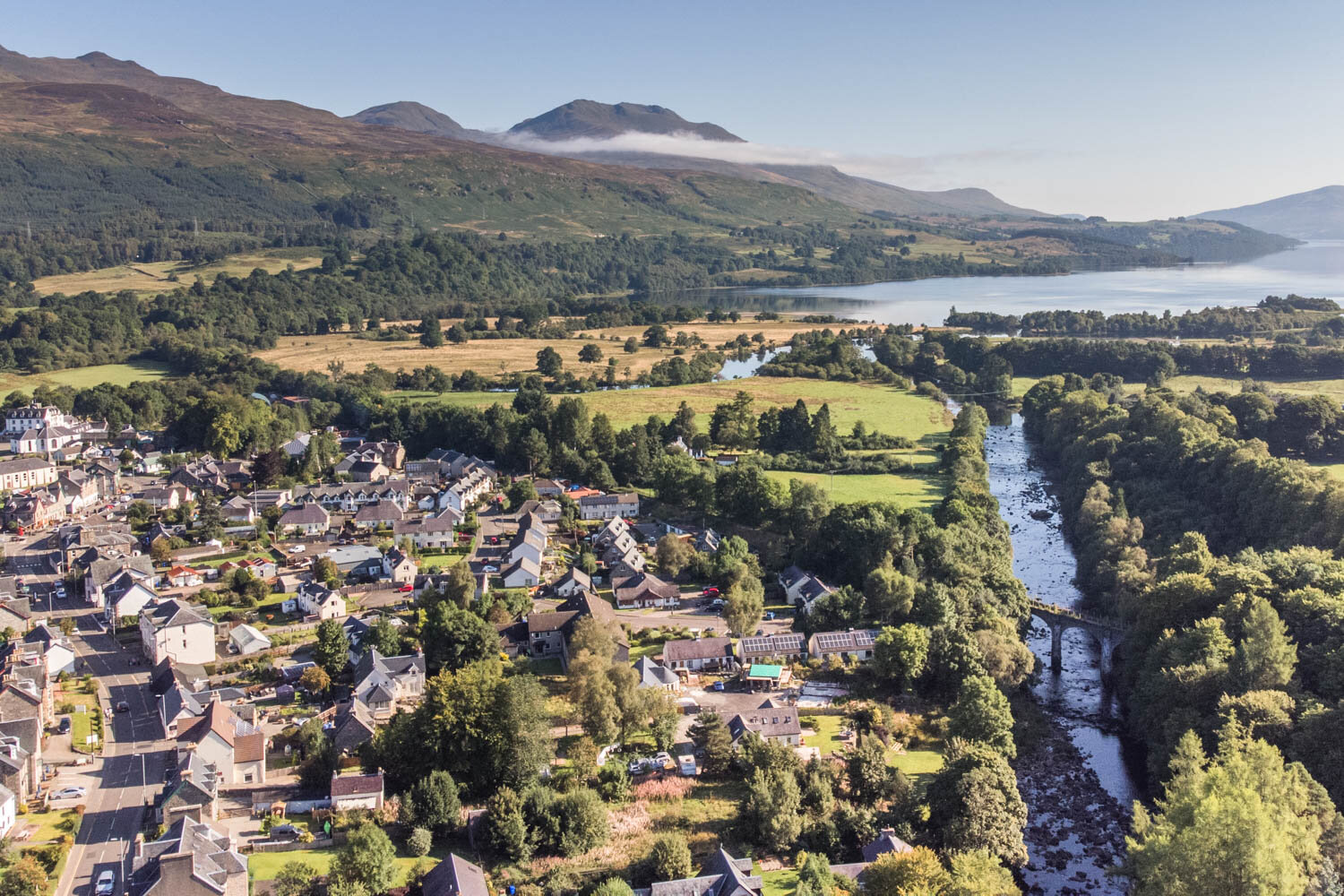
Killin Aerial View
Where is Killin?
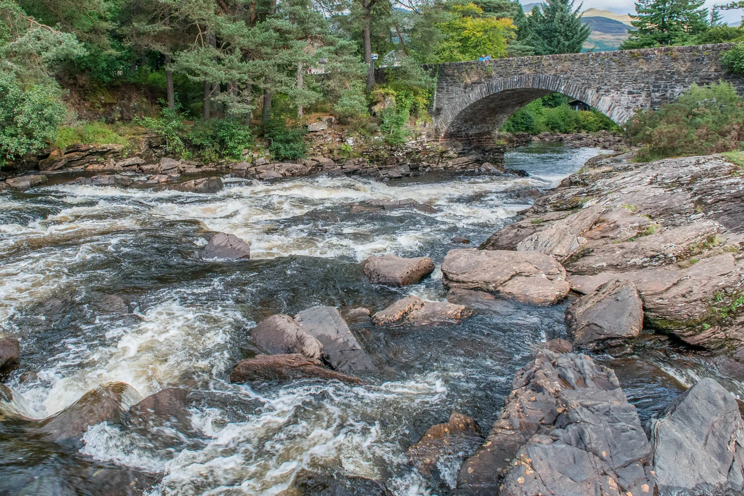
Killin is a pretty village, close to the edge of the National Park and the western head of Loch Tay. The dramatic Falls of Dochart cut through the village, with the A827 heading over a bridge across them. If you want to see more photographs of the falls, please see our separate guide to them.
The aerial photograph of the map shows the dramatic scene with the river, loch and mountains that surround the village. Zoom in and out of the map below to see Killin’s position.

Clan MacNab Burial Ground, Killin
Clan MacNab Burial Ground
From the bridge over the falls, you can see the ancient Clan MacNab Burial Ground on Inchbuie Island in the River Dochart. There is a locked gate, and it is possible to gain access for a small fee (details are on the gate.)
As well as the beautiful falls, there are beautiful mountains to add to the beauty of this small village; these are Ben Lawers and Tarmachan ranges, part of Ben Lawers National Nature Reserve, with Ben Lawers, the highest mountain in the Central Highlands.
The only blight on the landscapes is the electricity pylons, but thankfully, a project is underway to remove these, which will improve the natural landscapes.
Around 1,000 people live in Killin, a close-knit community as many facilities are some distance away. There are several local shops serving locals and a growing number of tourists.

Dochart Bridge, Killin
Eternal Mountain
I highly recommend a guided walking tour by Patrick of Eternal Mountain. Patrick has an infectious personality, with love and knowledge of the mountains. Here is a video we produced for him showing the incredible landscapes at Killin where he runs his guided walking tours.

Scenic Scotland
Video/Photo scenic stock library
Neighbour Food Killin
We recently made this film about the local Neighbour Food but wanted to share it on this page, because as you will see this a service that can benefit visitors to the village.
NCN7 Cycle Route
One of our most enjoyable visits to Killin was by bike, having cycled one of the most exciting sections of NCN7 Lochs and Glens Way from Strathyre to Killin. After crossing the Glen Ogle Viaduct, it was downhill through Acharn Forest before arriving in Killin at the Falls of Dochart. There is a bike hire shop in the village if you want to follow NCN7 in either direction from the village.
River Lochlay
There is a pretty spot by the Killin Hotel, along the River Lochlay.


Marketing Support
Strategy, Web, Video & Photography

Breadalbane Park
Breadalbane Park
Killin was awarded a Green Flag Award in 2019 by Keep Scotland Beautiful, recognising their well-maintained green spaces. Breadalbane Park is a fine example, with a children's playground, football pitch, all set with the backdrop of the magnificent Sron a' Chlachan, with the path to climb it starting in the park. The park also hosts the Killin Highland Games each summer.
Fingal's Stone
Fingal's Stone is a single standing stone, apparently to mark the grave of the mythical Celtic hero Fingal, Fionn mac Cumhaill or Finn McCool. The stone was moved though in the late 1800s, so this may not be the exact spot.

Fingals’ Stone, Killin
Loch Tay
The Head of Loch Tay is beautiful and easily accessible from the village. In fact the walk between the Head of Loch Tay and Falls of Dochart is just over a mile, along the former route of the long-gone train line. This concludes this guide to Killin, one of the most beautiful villages in the National Park.
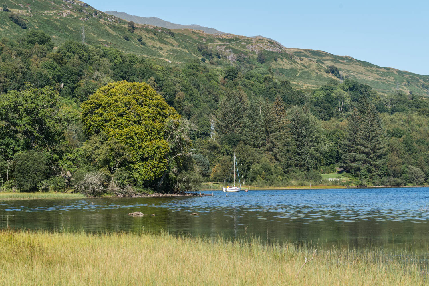
Loch Tay at Killin
Thanks for reading
Words and photography by Paul Saunders. Visit Paul’s Marketing and Photography websites for details of his services in Scotland.
Please let us know if you found the guide helpful in the comments section below.

Buy our guidebook, 101 Things to Do in Loch Lomond and the Trossachs, packed with attractions, views, and activities to enjoy.