
Share

Scan the QR code and open PeakVisor on your phone
Scan the QR code and open PeakVisor on your phone
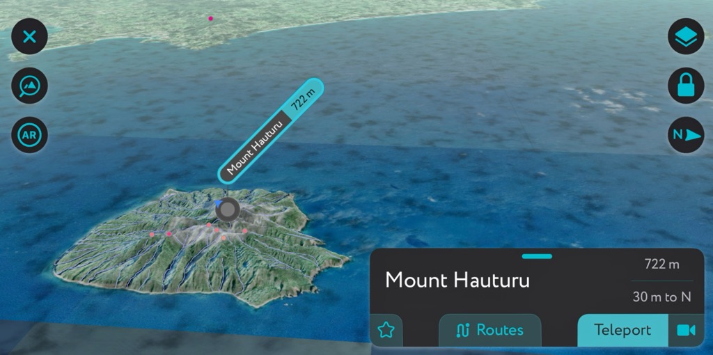
The Auckland region is in New Zealand’s North Island. It encompasses dozens of ecosystems ranging from montane forest to volcanic slopes to wetlands and coast, as well as the country’s largest urban center, the city of Auckland. There are 192 named mountains; Mount Hauturu (722 m / 2,369 ft) in the Little Barrier Island Nature Reserve is the highest and most prominent peak.

Located on the North Island of New Zealand, the Auckland region includes the city of Auckland, a number of small islands in the Hauraki Gulf, and ecosystems including volcanic slopes, wetlands, and rainforest.
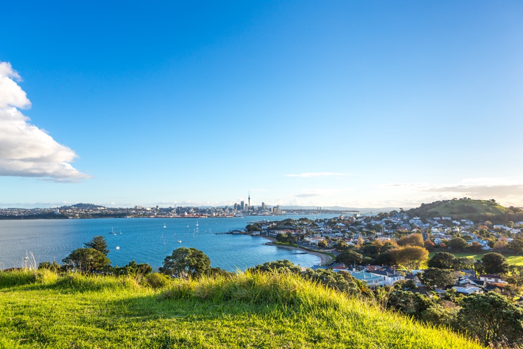
The city itself sits with the Hauraki Gulf of the Pacific Ocean to the east, the Hunua ranges to the south-east, the Manukau Harbour to the south-west, and the Waitakere ranges, plus other small ranges, to the west and north-west. Auckland is one of only a few cities worldwide that has harbors on two bodies of water. The isthmus touches both the Tasman Sea and the Pacific Ocean.
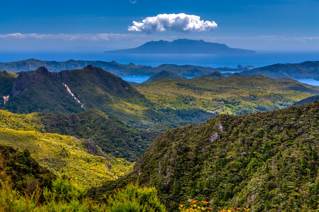
Auckland offers a diverse array of outdoor activities. In a single day, visitors can go from sailing to hiking through a rainforest to climbing a volcano. The region contains 26 conservation parks, including Duder, Shakespear, Tapapakanga, and Āwhitu. The Waitakere Ranges Regional Park boasts hundreds of kilometers of trails; the region’s largest native forest is in Hunua Ranges Regional Park. Islands include Little Barrier Island, home to the country’s first nature reserve, and the Great Barrier Island, with trails, hot springs, and surfing beaches.

Greywacke basement rock, dating back to the Mesozoic era, underlies the Auckland region. This basement rock developed at the edge of the supercontinent Gondwana between 300 and 150 million years ago. Sand, mud, and ash from rivers and volcanoes accumulated along the continent's periphery.
Over time, the sediment hardened, uplifted, and faulted, transforming into the greywacke and argillite seen today. Later, as the New Zealand land mass broke away from the supercontinent and was partially submerged beneath the ocean, new sediment gathered and compacted into sandstone and mudstone. This secondary layer of sedimentary rock, shaped by uplift and erosion, is known as the Waitemata Group. It’s visible in the layered cliffs along coastal areas.

A broad scope of geological variation occurs throughout the region. The underlying greywacke basement rock is visible in the Hunua Ranges and some of the Hauraki Gulf islands. The central isthmus and north shore contain Miocene and older sedimentary rock; the Waitakere Ranges display Miocene andesite-dominated volcanic rocks; southern Auckland has quaternary basalt volcanoes and deposits, while central Auckland has younger volcanos.
Starting around 250,000 years ago, rising magma beneath the earth’s surface created the Auckland Volcanic Field. The field is undoubtedly Auckland’s most distinctive geological feature. It consists of about 50 monogenetic (erupt only once) volcanoes dispersed throughout the city center and surrounding region; most have been preserved in some way as parks or green spaces.

The Auckland region spans diverse habitats and ecozones. Three dozen distinct ecosystems exist, including forest and scrublands; riparian zones, estuaries, rivers, ponds, lakes, and wetlands; and volcanic cones, dunes, and islands.
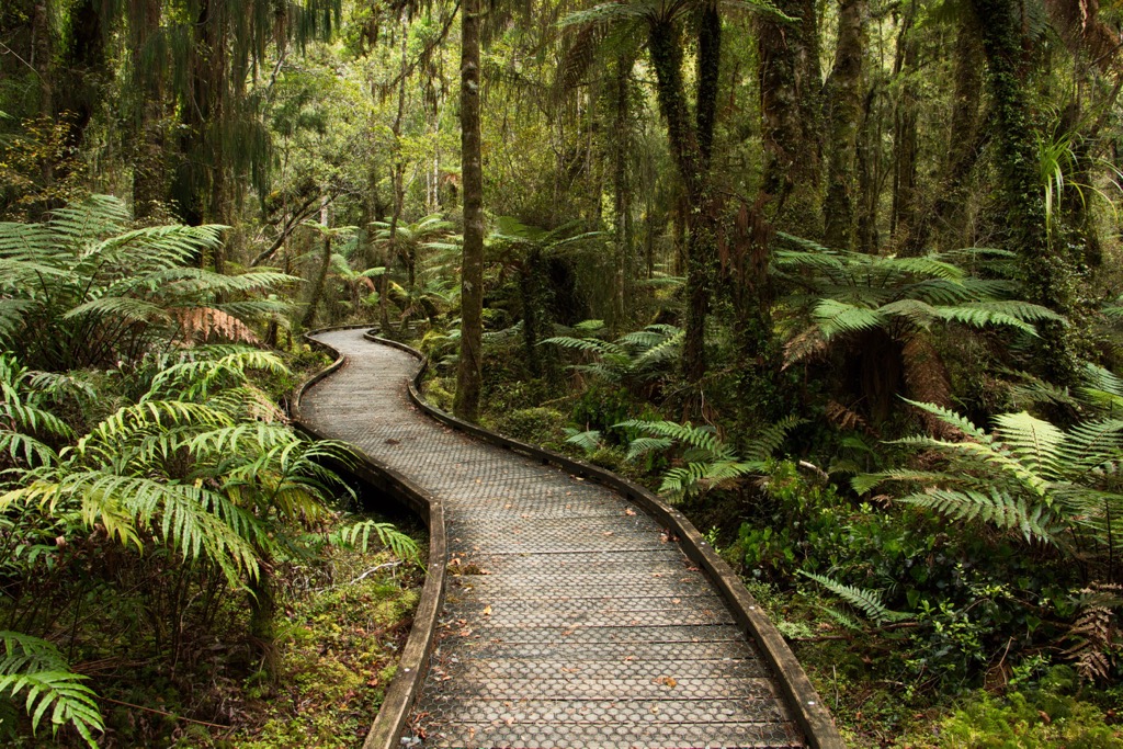
There are several forest ecosystems – broadleaved forests on the coast, pūriri forests on volcanic and alluvial soil, and montane and cloud forests in the Hunua and Watākere ranges and Little and Great Barrier Islands. Many forests have been damaged and threatened by human activity. Less than one percent of the natural dune forest remains, and there are significant threats to the kahikatea forests of swamps and floodplains.

Further ecosystems include cliff ecosystems, wetlands, and geothermal and cave systems. Within these varied habitats live several endemic and endangered species.
A wide array of birdlife exists across habitats, with a few common species being tomtits, silvereyes, and pukekos. Visitors may spot tiny penguins called kororās. There are also reptiles, including geckos and skinks.
There are several biodiversity focus areas in the region. Among these are the Albany Scenic Reserve wetland, the Huia within Waitākere Ranges Regional Park, the Karekare Dunes, and the Manukapua Island and Okahukura Sequence.

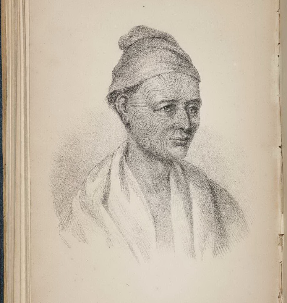
The area of present-day Auckland was once a Māori settlement called Tamaki MakauRau. The Māori first settled the area around 1350. It was an advantageous location – a narrow isthmus with easy access to the ocean and fertile soils.
The Māori tribes living there, the Ngati Whatua and Tainui, came into frequent conflict. Europeans, arriving in earnest in the 1840s, traded guns and ultimately swayed power in favor of the Ngati Whatua, who eventually defeated the Tainui.
In 1840, Te Kawau, a prominent chief of Ngati Whatua, and six other chiefs, signed the Treaty of Waitangi, ceding land around present-day Auckland to the British. This purchase of about 1,215 ha (3,000 acres) set the foundation for British colonial settlement. William Hobson was the first governor and chose it as the country's capital.

Within a year, 2,000 settlers had moved in, and the number only continued to grow. Although some upper class were present, most settlers were farmers, mechanics, shopkeepers, and servants.
In 1865, the capital shifted to Wellington, and a few years later, the Government House followed. The first nature reserve on Little Barrier Island was formed in 1895, the first in many land use decisions to protect the region’s natural resources and ecosystems.

Mount Hauturu is the highest peak in the region but is not a top hiking destination because it lies within the Little Barrier Island Nature Reserve. This island is spectacular and protects several rare and endangered species, but it is not as accessible as many other parts of the Auckland region. Fortunately, there are plenty of other hiking spots to explore the region’s mountains and biodiversity.
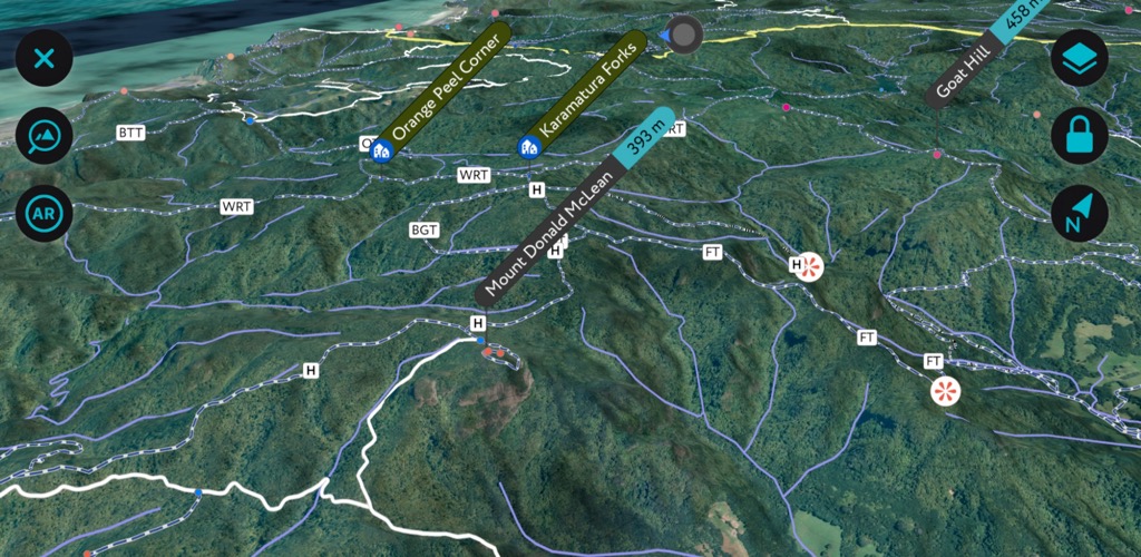
For the best hiking experience, check out the PeakVisor mobile app. You can visualize the mountains on our 3D maps and find all the best hikes already loaded onto our database.
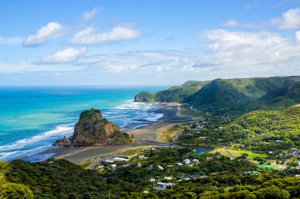
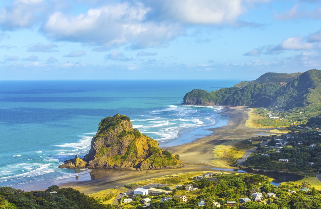
Waitakere Ranges Regional Park is only a 40-minute drive from Auckland. Once there, 250 km (155 mi) of trails are yours to explore, whether you want a half-day scenic walk or a multi-day trek. The park also offers surfing and scenic coasts along the picturesque black-sand beaches of Whatipu, Karekare, Piha, Bethells, and Muriwai.

Some easy and popular trails include the trail to Karekare Falls, the Kitekite track, and Mercer Bay Loop. Of the multi-day routes, one popular trek is the Hillary Trail – a 77 km (48 mi), four-day excursion through thick native forest and along the rugged coast.
Some trails are closed to prevent the spread of kauri dieback disease, a fungus-like pathogen that attacks the kauri tree root system. Be sure to check trail closures when planning.

The Hunua Ranges cover 40,000 ha (98,840 acres) in the region’s southeast. Much of the range lies within Waharau Regional Park. Trails here cut through thick forest, past waterfalls, and lead to scenic lookout points. In addition to hiking, there are several campsites, mountain biking trails, and fishing along the Mangatawhiri and Mangatangi dams.
Duder Regional Park is less than an hour from the city center. The classic loop trail of the peninsula is 6.3 km (3.9 mi) and has 178 m (583 ft) of elevation gain. The route offers beautiful views of the Hauraki Gulf, and there are ancient remains of a Māori settlement at the far point of the peninsula. It’s a popular route for hikers, birders, and mountain bikers, so you’ll share the trail with others.
Auckland is New Zealand’s most populous city (1.66 million) and features the largest international airport. As much as there is to do outside the city, the neighborhoods also have their charm.
Distinct neighborhoods highlight boutique shops, trendy eateries, and pristine beaches. The Auckland War Memorial Museum and Auckland Art Gallery Toi o Tāmaki provide insight into the area’s culture and history. There are numerous day trips from the city, such as kayaking to the nearby dormant volcano island Rangitoto (the only Auckland volcano to have erupted more than once).
The city boasts restaurants representing numerous international cuisines. There are Māori-inspired dishes and New Zealand favorites like fish and chips and pavlova. Budget-conscious travelers can find hostels and camping spots outside the city, while those looking for a more lavish experience can find waterfront hotels or glamping experiences.

Explore Auckland with the PeakVisor 3D Map and identify its summits.

